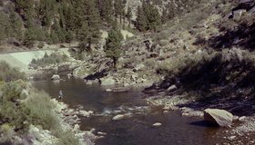
Improving Seasonal Water Predictions Using a Machine-Learning River Forecast System
A WWAO collaboration has published a new paper on how to use next-generation satellite snow data to improve seasonal water supply forecasts using machine learning.
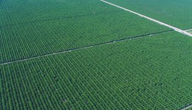
Field-Scale Crop Water Consumption Points to Potential Water Savings in Agriculture
Using remote-sensing data and machine learning, a team from NASA and beyond finds that switching to lower-intensity crops can reduce water consumption in California’s Central Valley by 93%, but this requires adopting uncommon crop types.
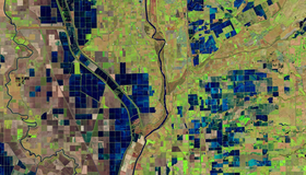
OpenET Study Helps Water Managers and Farmers Put NASA Data to Work
As the world looks for sustainable solutions, a system tapping into NASA satellite data for water management has passed a critical test.

From Space to Farm
Farmers rely on the Landsat satellite to make decisions about crops, with far-reaching implications that can impact what we see on our dinner plate. In this curious video, Landsat's view of crops from space can be heard in the form of music.
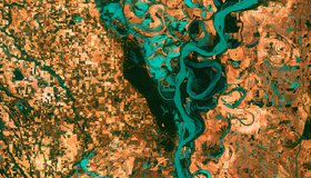
One Third of U.S. Rivers Have Changed Color
Rivers are among the most degraded ecosystems on Earth. The first map of river color from Landsat surface-reflectance data shows one third of U.S. rivers have changed color significantly over the last 35 years.