Our mission is to improve how water is managed in the arid western U.S. by getting NASA data, technology, and tools into the hands of water managers and decision makers.
Innovation, communication, and collaboration are at the heart of WWAO’s strategy. Our work focuses on four key areas:
Identifying Needs in western water management for information and decision support. WWAO achieves this through:
Building Projects tailored to meet those Needs, engaging with stakeholders from beginning to end. WWAO does this by:
Making Connections between stakeholders and NASA scientists, technology, tools, and data. To do this WWAO:
Transitioning water applications and technology into an operational, sustainable state for long-term impact. For this, WWAO:
Worldwide today, it is estimated that over 1 billion people live without access to adequate water supplies and about 2.6 billion people lack adequate water sanitation. Improved understanding of water processes at global and regional scales is essential for sustainability.
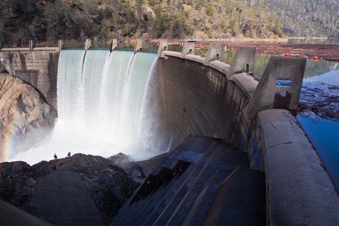
The western United States is expected to bear the brunt of impacts to water resource availability because of changing precipitation patterns, increasing temperatures, and a growing population. The west is already starting to feel the impacts and is taking action to develop new adaptive management practices to ensure a safe and reliable water supply, while maintaining healthy ecosystems throughout the state.
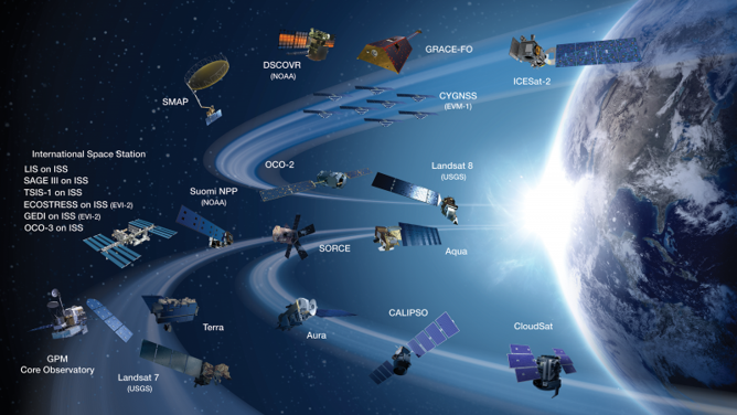
NASA is one of the world's leading climate and Earth research agencies. Scientists have been using NASA satellite, airborne, and computer-model data to study our planet for more than 40 years. With its fleet of satellites and remote-sensing expertise, NASA has a unique set of eyes over our planet that can bring the power of perspective to solve issues affecting people’s lives.
Today’s water managers need new approaches and new knowledge, some of which can only be gathered by remote sensors that see large areas and long timescales. Water planning practices – including those that rely on local data collection and analysis – can be improved using new data, higher-resolution and wider-area measurements, as well as state-of-the-art computer modeling.
Many water managers acknowledge the potential of NASA’s data for supporting decision-making but often face difficulties in applying it effectively in their daily operations. This challenge arises in part from the technical expertise and resources required to access, process, and interpret the data for practical use.
NASA researchers are working with water managers to apply their expertise and data (satellite, airborne and ground-based) to deliver actionable information on water availability, water use, water quality and water infrastructure. We partner with universities, government agencies and other stakeholders. NASA's projects include developing better estimates of snowpack, as well as monitoring groundwater, soil moisture, evapotranspiration, water quality, and fragile levee systems.
WWAO is a NASA program focused on all things water. While physically headquartered at NASA's Jet Propulsion Laboratory in Pasadena, California, it is a cross-NASA initiative with a team representing all of the NASA centers. WWAO is part of a larger effort within NASA's Applied Sciences Program to help society through NASA’s data, tools and technology. It is part of NASA’s Applied Sciences Program, which covers Earth science and encompasses five application areas: Health and Air Quality, Ecological Forecasting, Disasters, Wildfires, and Water Resources. WWAO forms a core part of the latter of these thrusts – water resources.
WWAO leverages decades of NASA investment in science and technology to deliver useful, actionable information to those on the ground making water decisions and shaping policies that potentially affect millions of people.
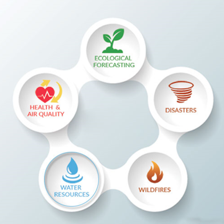
The five focus areas of NASA’s Applied Science Program. WWAO is part of the water resources thrust.
Scientists have been using NASA satellite, airborne, and computer-model data to study our planet for more than 40 years. The impacts of NASA’s sustained investments have been significant, both to our general scientific knowledge and to the thousands of public and private sector institutions that have incorporated and built on this expertise.
NASA offers unique capabilities that can be used to provide actionable information about water availability, extreme events such as flooding and drought, water quality, user demand, and infrastructure integrity.
Many water managers recognize the value of NASA’s data to decision support but they also find it challenging to use the data operationally. In many cases, water managers lack the scientific and technical resources to access, process, or analyze the information for decision making.
Moreover, the western water landscape is very complex. A vast number of players have been established over many years to ensure that water is captured where possible and available where needed. This system offers very little uniformity or centralized control, yet has nonetheless delivered water for over 150 years.
WWAO was created to address these challenges and accelerate the application of NASA observations and scientific analysis techniques to tangible, important, and timely water problems. It arms water stakeholders with valuable scientific resources about the changing hydrology of the American west, thus helping them to make better, more informed decisions.