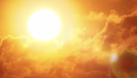
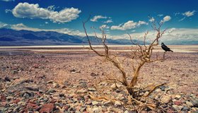
Drought Brings the Heat: New Research Finds Drought Lengthens Heat Waves
The intersection of drought and heat can have numerous impacts, including the increased chance of wildfires, reduced supplies of water and even lengthen the duration of heat waves.
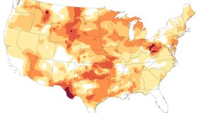
Drought Expands Across the U.S.
Dry conditions parched all but two states in October 2024 and worsened as the month progressed.
Mapping Groundwater-Dependent Ecosystems
Many diverse ecosystems rely on groundwater for a stable water supply. Species can rely directly or indirectly on groundwater for some or all their water requirements, depending on a multitude of factors.
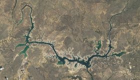
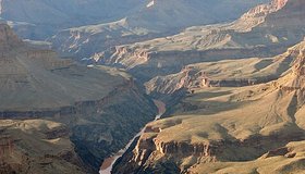
Dry in the Rio Grande Basin
Amid drought in southern Texas and northern Mexico, Amistad Reservoir has hit record-low levels.
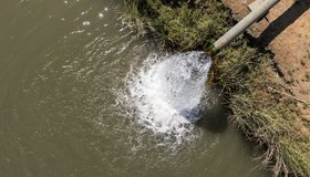
Funding Available to Support Drought Assessment in a Changing Climate
NOAA's National Integrated Drought Information System is investing up to $4M to support drought assessment in a changing climate.
Potential Relief for the Colorado River’s Near Future
Precipitation could boost the iconic river’s flow in the next couple of decades despite the deleterious effects of warming temperatures due to climate change.

Average is Awesome: California Happy With Latest Snowpack Survey
After years of swinging extremes, state snowpack is at rare average of 110%, setting up good water savings account for year ahead.
Improving Seasonal Water Predictions Using a Machine-Learning River Forecast System
A WWAO collaboration has published a new paper on how to use next-generation satellite snow data to improve seasonal water supply forecasts using machine learning.

California Mountains Face Weather Whiplash
Last month’s massive snowstorm in the Sierra Nevada followed a dry start to winter. Such extremes in precipitation may become the norm.
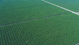
Field-Scale Crop Water Consumption Points to Potential Water Savings in Agriculture
Using remote-sensing data and machine learning, a team from NASA and beyond finds that switching to lower-intensity crops can reduce water consumption in California’s Central Valley by 93%, but this requires adopting uncommon crop types.