Satellites Improving Flood And Landslide Monitoring
NASA scientists Dalia Kirschbaum and Maggi Glascoe are using satellite data to pioneer improved landslide and flood alerting around the world.

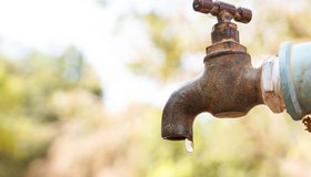
Carrying Water For The Community
Water is critical for the arid, underserved Navajo Nation. Carlee McClellan, Navajo hydrologist, is working with WWAO to deliver a space-based solution for monitoring water availability.
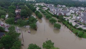
Pacific North-West Cleans up after Floods, Braces for More Rain
Atmospheric rivers have pummeled the region, resulting in the deaths of two people in rushing floodwaters.

El Niño Forecast to Contribute to Food Insecurity
Shifting rainfall patterns are projected to leave millions of people without consistent access to food in late 2023 and early 2024.
NASA Earthdata Floods Toolkit
About 40% of the world's population live within 100 km of the coast, and floods affect more people than any other type of natural disaster. NASA's floods toolkit offers easy access to NASA Earth data that can help scientists and decision makers understand floods, respond to them, and map their impact.
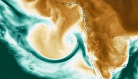
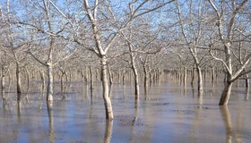
Atmospheric River Lashes California
The latest in a series of atmospheric rivers drenching the state was accompanied by hazardous winds and left thousands of people without power.
Disparities in U.S. Water Access
A new study reveals key disparities in piped water access in urban U.S. areas. From 2013 to 2017, 1.1M people had insecure water access, with half located in the 50 largest metropolitan areas. Gaps in water access are underpinned by precarious housing conditions and systemic inequality.