Carrying Water For The Community
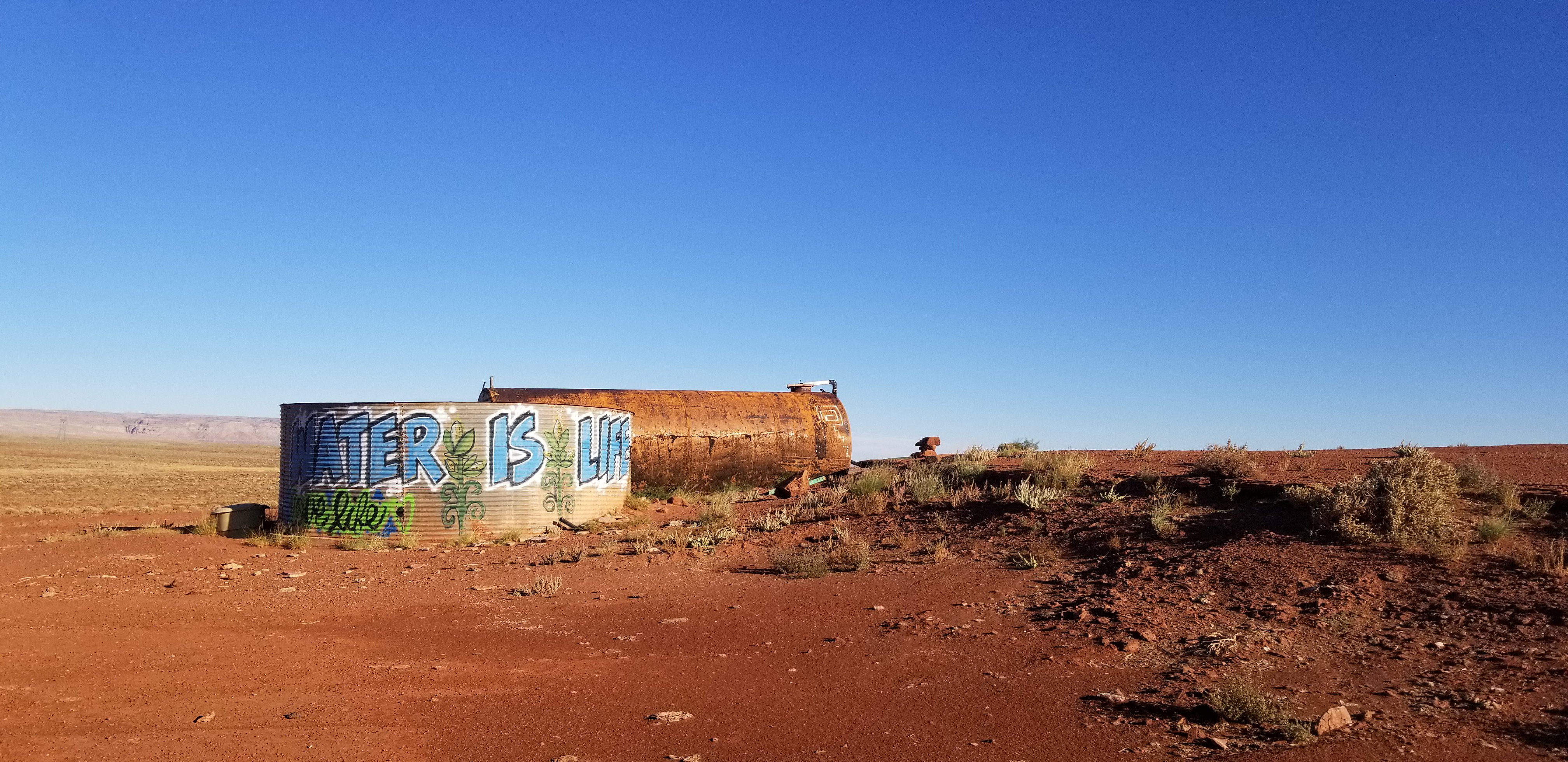
Photo of a water tank on the Navajo Nation near Grey Mountain, Arizona. Credit: Carlee McClellan.
Water is a crucial resource for the Navajo Nation, which spans some of the driest states in the U.S. – Arizona, New Mexico and Utah. Sparse infrastructure leaves more than 40 percent of Navajo households without running water.
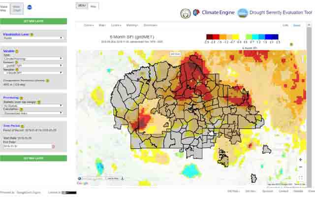
That makes Carlee McClellan's job critical. Born and raised Navajo, McClellan is the senior hydrologist for the Navajo Nation Department of Water Resources. He's working with NASA's Earth Applied Sciences Program to include NASA Earth observations in the Nation’s water decision making. Called the Drought Severity Evaluation Tool, the user-friendly web application combines many datasets such as precipitation and temperature from NASA satellites with drought metrics from models, and ground-based rain measurements.
It's a high-tech, space-based way to monitor the Nation's resources for drinking water and irrigation – and McClellan says working with NASA data is just one of the many surprises he's had in his career. In fact, when he was growing up, he did not expect a career in science at all.
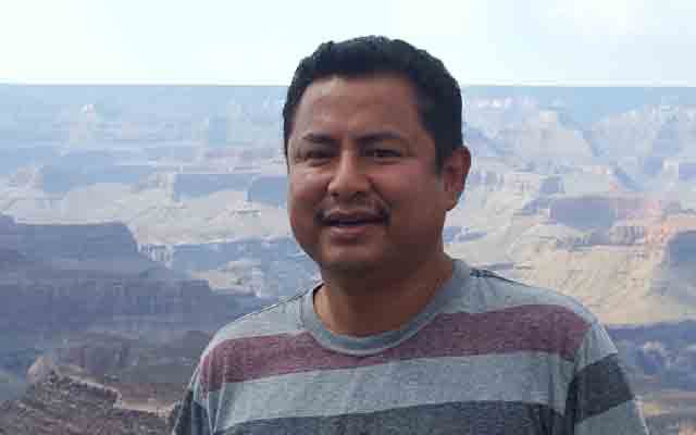
Carlee McClellan, senior hydrologist for the Navajo Nation Department of Water Resources. Credit: Rebecca McClellan.
McClellan's mother is a teacher's aide and artist who received a high school education, while his father, a cowboy and rancher, left school after 6th grade. "They raised me with the older, traditional upbringing of Navajo lifestyle – my mom still doesn't have running water to her home," explained McClellan. "We hauled water, we went into the mountains to cut firewood, and we took care of the animals. So when people asked me what I wanted to be when I grew up, I said 'I don't know, a rancher?'"
“It is monumental to have an organization like NASA work with us to diversify and augment the water tools we have at our disposal.”
His older sister was the first one to suggest college. Though he struggled in high school, McClellan took an inquisitive interest in chemistry. He often helped his maternal grandmother in the garden, chopping wood, hauling water – and peppering her with questions she couldn't answer.
"She only spoke Navajo," McClellan recalled, "and I'd ask her, 'How can we take clay, turn it into pottery, and it doesn't turn back to mud?'" When his grandmother couldn't answer, he turned to his high school chemistry teacher for answers. She suggested he could gain some much-needed extra credit by researching his own questions and writing reports on what he found.
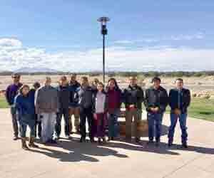
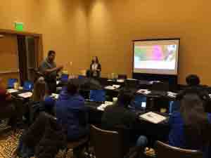
Navajo Nation remote sensing and drought workshop in Flagstaff, Arizona, April 2019. Credit: Amber McCullum, NASA.
That same teacher was impressed by the work McClellan put in, and it marked a turning point. Her husband, an organic chemistry professor at Northern Arizona University in Flagstaff, offered him a research position over the summer. For McClellan, this confirmed his love of science – and he stayed to pursue a degree in chemistry. He dropped out in his last year of school to find work in Tucson, but "after a few years of odd jobs, I knew it was time to go back to school," explained McClellan. First, he started with community college, then transferred his hours to the University of Arizona to complete his bachelor's degree in chemistry.
McClellan then worked for various environmental consulting firms and laboratories, focusing on water quality and hazardous waste. But in the summer of 2015, he was ready to leave the laboratory for the field. That's when he found an opening with the Navajo Nation, which was wrapping up a project with NASA DEVELOP. DEVELOP, part of the Applied Sciences Capacity Building Program at NASA, works to build up the ability of partner organizations to use Earth observations to address environmental and public policy issues.
"The [DEVELOP] project was short-term by design, but the resulting web application was written in a coding language that was difficult to use. I explained to NASA that we needed something more user-friendly – and they immediately came up with a potential solution."
The DEVELOP work then transitioned into an effort supported by NASA's Western Water Applications Office (WWAO). The team partnered with the Desert Research Institute (DRI) to expand the project into a customized tool, as a spin-off of the popular Climate Engine to directly meet the community's needs. Climate Engine uses Google’s Earth Engine to process, on-demand, satellite and climate data via a web browser. McClellan and colleagues plan to finalize the Drought Severity Evaluation Tool in the summer of 2020.
Looking forward, McClellan thinks another important target for measurement is snowpack, particularly in the Chuska Mountains, which on average contain nearly 80% of the Nation’s snowpack. The ability to better understand this vital resource will be useful for water management, agriculture and cultural activities.
"A lot of this work had not yet been done – what we're doing with the Drought Severity Evaluation Tool is pioneering," McClellan said. Bringing the unique perspective we get from space and using it on Earth has the potential to revolutionize McClellan's job as the Nation's senior hydrologist. While the Nation began monitoring surface water in the 1980s, there are only 85 rain gauges to cover the entire reservation which, with an area covering 17,544,500 acres, is larger than West Virginia. "The Navajo Nation has been pretty underserved in monitoring surface-water needs," he said.
That's one of many reasons McClellan is proud to be doing this work for the communities he grew up with.
"I'm full-blooded Navajo – I grew up on the Navajo Reservation," McClellan said. "It is monumental to be able to have an organization like NASA and others work with us to diversify and augment the water tools we have at our disposal. For us this is a great blessing."