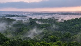
New Radar Mission to Provide Dynamic View of Forests, Wetlands
NISAR will help researchers explore how changes in Earth's forest and wetland ecosystems are affecting the global carbon cycle and influencing climate change.
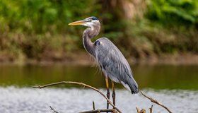
Global Wetlands Losses High But Overestimated
Although wetlands remain threatened in many parts of the world — including the U.S., which accounts for more losses than any other country — worldwide wetland losses have likely been overestimated, according to a new study in Nature.
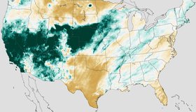
Atmospheric Rivers Take Chunk Out of Drought
Nine atmospheric rivers dropped feet of rain and snow across California and the West Coast from late December to mid-January. The deluge caused deaths, landslides and flooding, but improved the drought situation across a large chunk of the western United States.
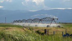
NASA Measures Underground Water Flowing From Sierra to California's Central Valley
This source accounts for about 10% of all the water that enters this highly productive farmland, including rivers and rain.
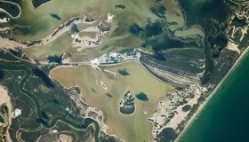
Rio Grande, Meet the Gulf of Mexico
Colorful waterways and wetlands are visible along the river that defines a portion of the U.S.-Mexico border.
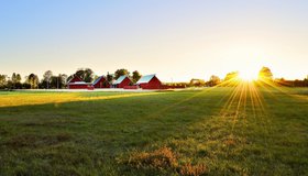
Satellites Show Uptick in Cover Cropping on Farms
Big ag can be hard on the planet, with land often left barren between planting, leading to erosion of top soil. New results show farms in the U.S. Midwest are increasingly planting cover crops, benefitting the environment in a myriad of ways.
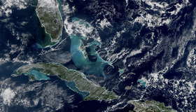
First Images Released From NOAA-21 VIIRS Instrument
Bright blue water in the Caribbean Sea and smog in Northern India appear in the first worldwide image produced with data from NOAA-21’s VIIRS instrument, which began collecting Earth data in December. VIIRS offers global insight into our atmosphere, land, and oceans.
Which Wetlands to Protect? Supreme Court to Decide
The U.S. loses about 60,000 acres of wetlands a year. An upcoming Supreme Court decision could settle which wetlands get federal protection under the Clean Water Act.
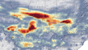
Extreme Rainfall Deluges The Midwest
Record-breaking rain brought devastating flash floods and landslides to the central U.S. at the end of July 2022. Climate change makes extreme precipitation and weather more likely.
Satellites Show Water Cycle Ramping up as Climate Warms
For years, scientists looked for ways to measure large-scale changes in Earth’s water cycle. Satellites measuring the gravity of water delivered. From 2003 to 2019, land evapotranspiration increased by 10%, one sign that our water cycle is ramping up.