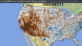
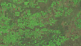
NASA Data Power New Soil Moisture Portal
WWAO's new soil moisture data portal - Crop-CASMA - is live. Crop-CASMA, which provides high-resolution, field-scale soil wetness from NASA satellites in an easy-to-use format, is a collaboration between NASA, the U.S. Department of Agriculture and George Mason University.

Humans Shifting Earth's Surface Water Storage
Using NASA's Ice, Cloud and land Elevation Satellite 2 (ICESat-2), scientists have shown humans are having a much bigger impact on surface storage variability than previously thought, with over half of the planet's variability happening in managed reservoirs.
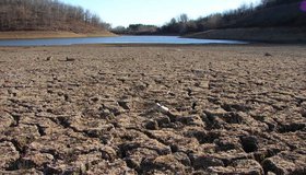
California’s Rainy Season Now Starts a Month Later
California's annual rainy season now begins a month later than it did just 60 years ago, shifting from November to December. The results are consistent with climate models that predict drier autumns for California in a warming climate.

WWAO Request For Information
WWAO is launching new water projects in the U.S. Columbia River Basin. As part of this effort, we’re looking for information on activities using NASA data or technology that could address key water issues in the region.
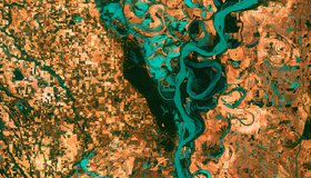
One Third of U.S. Rivers Have Changed Color
Rivers are among the most degraded ecosystems on Earth. The first map of river color from Landsat surface-reflectance data shows one third of U.S. rivers have changed color significantly over the last 35 years.
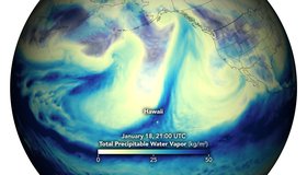
Potent Atmospheric Rivers Douse Pacific Northwest
In mid-January, the U.S. Pacific Northwest was soaked by several episodes of heavy rainfall, leading to widespread flooding and landslides. NASA data show these rivers in the sky.

Climate Change Shifting Earth’s Rain Belt
Work from UC Irvine and NASA shows climate change will move Earth's tropical rain belt, with cascading effects on water availability and potential threats to global food security.
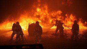
2020 Was Warmest Year on Record
2020 was a rough year for planet Earth, and NASA found it was the hottest on record. Our warming planet fanned the flames of extreme wildfires, drought and hurricanes.
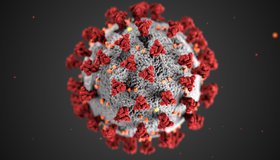
Seeing COVID From Space
NASA is tracking the effects of the COVID-19 pandemic on our air, land, water and climate. The data have been collected in a free, openly-available online dashboard.
NASA, USDA Increasing Innovation in Agriculture
A new agreement between the U.S. Department of Agriculture and NASA will strengthen agricultural and Earth science research. WWAO’s collaboration with the USDA on its High-Resolution Soil Moisture Project fits into this larger partnership.