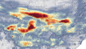
Extreme Rainfall Deluges The Midwest
Record-breaking rain brought devastating flash floods and landslides to the central U.S. at the end of July 2022. Climate change makes extreme precipitation and weather more likely.
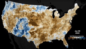
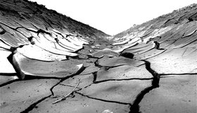
Tracking Deluge And Drought Through Soil Moisture
The changing state of U.S. soils has big implications for farmers and crop production. Our Crop-CASMA soil moisture tool shows how soil has changed over the past year in the U.S. from soaked to dry.
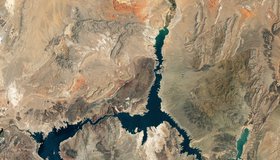
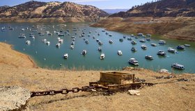
Nasa Images Show a Withering Lake Mead
Water in Lake Mead - the U.S.' largest reservoir - is at its lowest level since 1937 when the reservoir was filled for the first time. At just 27% capacity, NASA images offer a stark illustration of climate change and a long-term drought that may be the worst in the U.S. West in 12 centuries.
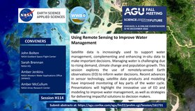
Call For Abstracts: Using Remote Sensing to Improve Water Management
WWAO is hosting a session at the 2022 American Geophysical Union Fall Meeting this December, jointly with NASA's Water Resources Program. Our session looks at how to improve water management using satellite Earth observations. We invite you to join us!

Event: 2022 National Water Use Data Workshop
The 2022 National Water Use Data Workshop will focus on improving water-data management and sharing. The event is led by WWAO collaborators including the Western States Water Council Water Information Management Systems Group, U.S. Geological Survey, Interstate Council on Water Policy, and Internet of Water.
Rare ‘Triple’ La Niña Climate Event Looks Likely
La Niña may be sticking around, unusually, for a third year running. This ‘triple dip’ event — lasting three years in a row — has happened only twice since 1950. It could mean more drought in the southern U.S. and become more regular as the planet warms.
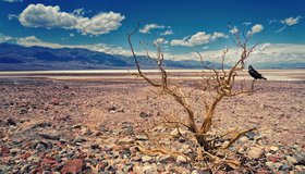
U.S. Megadrought is Worst For Over 1,000 Years
Vast swathes of the western U.S. are currently being affected by a megadrought, which started in 2000 and is almost in its 23rd year. Recent research suggests this ranks as the driest 22-year period in southwestern North America since at least 800 C.E.
California’s Largest Reservoirs Are Critically Low
Images from Lake Oroville and Lake Shasta compiled by the state show ‘a shocking drop in water levels’ compared to years past. California, like much of the U.S. West can expect a searing, dry summer ahead.
Event: NASA Earth Science Applications Week
Join us for NASA’s Earth Science Applications Week 2022! A three-day virtual celebration of the many ways NASA Earth science is being used to make our world a better place.
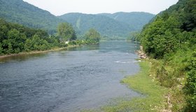
Flood Vulnerability in The Cheat River Watershed
Communities in the Cheat River watershed in West Virginia face frequent flooding, which threatens to reverse years of restoration work aimed at cleaning up pollution from mining. NASA has partnered with a local non-profit to help build resilience to future floods.