
From Space to Farm
Farmers rely on the Landsat satellite to make decisions about crops, with far-reaching implications that can impact what we see on our dinner plate. In this curious video, Landsat's view of crops from space can be heard in the form of music.
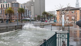
Sea-Level Projections Drive San Francisco's Plans
Access to the latest information about sea-level rise is crucial to many coastal cities. New NASA research is helping San Francisco plan measures to adapt to rising seas.
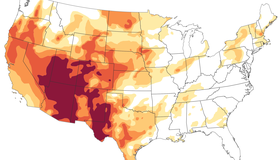
The Drying U.S. West
A serious drought has flared up across half of the United States, with about a third of the country suffering from extreme or exceptional drought. This familiar story has been playing out for the past two decades.
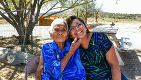
Connecting The Drops - Nikki Tulley, Navajo Nation
Nikki Tulley is a member of the Navajo Nation working with WWAO on its Navajo Drought Project. She explains why she's on a mission to help her community protect its most vital resource: water.
WWAO Passes The Baton to The Navajo
We have liftoff! NASA WWAO's new Drought Severity Tool is operational and has been handed off to its tribal partner, the Navajo Nation, as the project comes to a close.
New Ocean Satellite Releases Impressive First Data
Launched three weeks ago, the Sentinel-6 Michael Freilich satellite has returned its first data and is surpassing expectations. The NASA-U.S.-European satellite will measure sea-level rise with unprecedented accuracy.

NASA-Navajo Drought Tool User Guide Launched
WWAO's Navajo Nation Drought Tool User Guide is now live. This marks a milestone in the transition of our Navajo Drought Project from research to decision makers, and is key to building capacity within the Navajo community to use the tool.
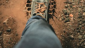
Biodiversity Beneath Our Feet
Increasing attention is being paid to soil biodiversity, which drives many processes that produce food or purify soil and water. A UN report highlights how critical soil organisms are, and how soil biodiversity can offer solutions to today's global threats.
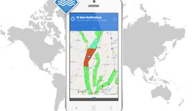
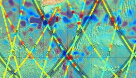
Early Access to Global Flood Tracking
Floods are the most deadly and costly natural hazard. A NASA team is streamlining access to real-time satellite data so disaster managers can make informed decisions, faster.
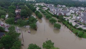
Satellites Improving Flood And Landslide Monitoring
NASA scientists Dalia Kirschbaum and Maggi Glascoe are using satellite data to pioneer improved landslide and flood alerting around the world.