pexels-melike-sayar-melikesayar-8001411
April 2, 2024

Average is Awesome: California Happy With Latest Snowpack Survey

After years of swinging extremes, state snowpack is at rare average of 110%, setting up good water savings account for year ahead.

2023_05_12_ZZ_0033_Farm_Land_Tulare_Lake
March 25, 2024

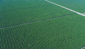
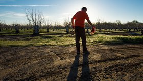
Field-Scale Crop Water Consumption Points to Potential Water Savings in Agriculture

Using remote-sensing data and machine learning, a team from NASA and beyond finds that switching to lower-intensity crops can reduce water consumption in California’s Central Valley by 93%, but this requires adopting uncommon crop types.

2023_12_14_KJ_0113_Lake_Levels
March 25, 2024

How Business and Government Might Solve the Freshwater Crisis Together

Does the public sector need the private sector’s help to address the freshwater crisis? 

2023_05_12_ZZ_0031_Tulare_Lake
March 24, 2024

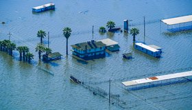
California Zombie Lake Turned Farmland to Water. Is it now Gone for Good?

Resurrected for the first time in decades by an epic deluge of winter rain and snow, by spring the lake covered more than 100,000 acres, stretching over cotton, tomato and pistachio fields and miles of roads.

2024_01_30_SN_0019_Oroville_Lake_Level_DRONE
March 22, 2024

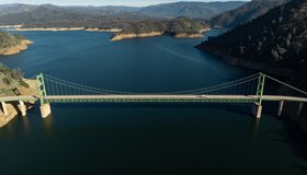
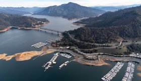
Storms Boost Forecasted California Water Supply

California's State Water Project has been focused on maximizing the capture and storage of water from this winter’s storms.

drops-of-water-water-nature-liquid-40784 _2
March 21, 2024

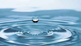
World Water Day: Water for Peace

This year’s theme, “Water for Peace,” encourages the world to focus not only on the conflicts, but also on how water can be at the center of peacebuilding.

1-GRACE-C_Engineer_well_depth.width-1320
March 20, 2024

US, Germany Partnering on Mission to Track Earth’s Water Movement

The Gravity Recovery and Climate Experiment-Continuity mission will extend a decades-long record of following shifting water masses using gravity measurements.

pexels-wendy-maxwell-12153265
March 18, 2024

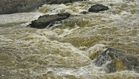
What’s Worse Than a Flood? A Debris Flow

While flood flows are dominated by water, debris flows are a slurry of a lot of things, including boulders. 

pexels-snow-white-884186
March 13, 2024

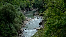
Climate Change Weakening River Seasonality in North

Seasonal flow variability is decreasing as climate change alters Earth’s systems, creating challenges for water management.

pexels-photo-1529360-a
February 29, 2024

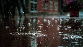
U.S. Cities Could Be Capturing Billions of Gallons of Rain a Day

With better infrastructure and “spongy” green spaces, urban areas have made progress but should be soaking up way more free stormwater.

3084_1-pia24531-swot_parag-clean-room-1041.jpg
May 6, 2021

New SWOT Satellite to Survey World's Water

How much water sloshes around in Earth’s lakes, rivers, and oceans? And how does that amount change over time? The upcoming Surface Water and Ocean Topography (SWOT) mission plans to find out.

shutterstock_545332705.jpg
April 21, 2021

NASA 2021 Water Resources Solicitation

NASA has released a 2021 solicitation for water-resource proposals through NASA's Research Opportunities in Space and Earth Sciences (ROSES). The first-round deadline is May 21, 2021.

nasascuriousuniverselogo-3000_0.png
December 16, 2020

From Space to Farm

Farmers rely on the Landsat satellite to make decisions about crops, with far-reaching implications that can impact what we see on our dinner plate. In this curious video, Landsat's view of crops from space can be heard in the form of music.

usdrought_usdm_2020345_lrg.png
December 14, 2020

The Drying U.S. West

A serious drought has flared up across half of the United States, with about a third of the country suffering from extreme or exceptional drought. This familiar story has been playing out for the past two decades.

navajo-drought-map-red2.png
December 9, 2020

NASA-Navajo Drought Tool User Guide Launched

WWAO's Navajo Nation Drought Tool User Guide is now live. This marks a milestone in the transition of our Navajo Drought Project from research to decision makers, and is key to building capacity within the Navajo community to use the tool. 

shutterstock_590086811.jpg
November 19, 2020

Disparities in U.S. Water Access

A new study reveals key disparities in piped water access in urban U.S. areas. From 2013 to 2017, 1.1M people had insecure water access, with half located in the 50 largest metropolitan areas. Gaps in water access are underpinned by precarious housing conditions and systemic inequality.

shutterstock_182262104.jpg
November 16, 2020

NASA's Water Portal Launched

Our new NASA Water Portal is now live. The portal serves as a hub for building connections between our catalogs of Water Data Needs and Water Capabilities and our partners, including water managers, decision makers, and scientists.

1970_09_07_BD_04052_024_Snow_Survey
April 1, 2024

Improving Seasonal Water Predictions Using a Machine-Learning River Forecast System

A WWAO collaboration has published a new paper on how to use next-generation satellite snow data to improve seasonal water supply forecasts using machine learning.

swot image.jpg
March 20, 2024

Webinar: Accessing Data for World's Water with NASA's SWOT Mission

Learn how to discover, access, and use Surface Water and Ocean Topography (SWOT) mission data and how these data could lead to new, innovative science and applications in the world of water.

2022_04_08_FL_0100_AEM_Aircraft
March 6, 2024

California Water Department Completes First Phase of Innovative Groundwater Mapping Program

State-of-the-art helicopter-based technology and local coordination improve management of our underground water supply.

pexels-alteredsnaps-13865772
March 6, 2024

SWOT Observes Coastal Flooding

The Surface Water and Ocean Topography satellite provides a new view of water on land, at the coast, and in the ocean.

carice-oli-2018360-highres.webp
February 1, 2024

OpenET Study Helps Water Managers and Farmers Put NASA Data to Work

As the world looks for sustainable solutions, a system tapping into NASA satellite data for water management has passed a critical test.

pexels-irrigation-sprinkler-on-field-10697615.jpg
January 24, 2024

Groundwater Is Declining Globally, But With Hopeful Exceptions

The most detailed global look at groundwater shows much loss but also stories of success in restoring some aquifers.

pexels-photo-13437374.jpeg
January 24, 2024

Groundwater Levels Around the World Are Dropping Quickly, Often at Accelerating Rates

Rapid declines are most common in aquifers under croplands in drier regions, including California, the most extensive analysis of groundwater trends so far shows.

2023_11_29_AN_0222_Maxwell_Groundwater_Subsidence.jpg
January 18, 2024

Milestone Towards Groundwater Sustainability in California

The state has finished reviewing sustainability plans for high- and medium-priority groundwater basins.

Klamath_tribes_dam_removal_demo.jpg
January 13, 2024

No turning back: The Largest Dam Removal in U.S. History Begins

In a win for local tribes, dammed reservoirs on the Klamath River are being lowered to save fish habitat and improve water quality.

FL_Poppies-7798_03_29_2019.jpg
January 9, 2024

Looking Back at 2023’s Volatile California Water Year

The driest three-year period on record gave way to a series of atmospheric rivers early in the year that pummeled the state.

alaska_sediment_amo_20231229_lrg.jpg
January 8, 2024

Colorful Swirls in the Gulf of Alaska

The burst of turquoise and tan hues in Alaskan waters is in stark contrast to the snowy shoreline.

2024_01_02_FG_0086_Snow_Survey.jpg
January 2, 2024

First Snow Survey of Season Finds Below-Average Conditions for California

With above-average reservoir levels, El Niño, and a dry start to the water year, California is preparing for flood or dry conditions in the months ahead.

2023_05_26_JW_0146_James_Irrigation_District_Pump_Program.jpg
December 12, 2023

California Plans to Capture Winter Storm Runoff

California's Department of Water Resources encourages groundwater recharge to maximize capture of upcoming storm runoff.

pexels-photo-3536511.jpeg
December 11, 2023

Quarter of World’s Freshwater Fish at Risk of Extinction

New assessment finds 25% of freshwater fish are at risk of extinction, and at least 17% of threatened freshwater fish species are affected by climate change.

free-photo-of-small-cabin-on-field.jpeg
December 11, 2023

Addressing Groundwater Overdraft in the Sacramento Valley

Though the Sacramento Valley has relatively abundant surface-water supplies, groundwater is also key for many of its communities and farms.

pexels-photo-1141853.webp
December 8, 2023

WWAO Hosting Town Hall on Science to Decision Making

Join us at our Science to Decisions town hall at the AGU Fall Meeting next week! Our fabulous speaker panel comes from NASA, NOAA, the U.S. Bureau of Reclamation, Colorado Climate Center, and the National Academy of Sciences, Water Science and Technology Board.

Flooded_walnut_orchard_in_Butte_County,_California-L1001234-2a.JPG
December 7, 2023

Pacific North-West Cleans up after Floods, Braces for More Rain

Atmospheric rivers have pummeled the region, resulting in the deaths of two people in rushing floodwaters.

Oroville_dam_aerial.jpg
December 1, 2023

California Announces Initial Allocation of 10 Percent to its State Water Project for 2024

California's Department of Water Resources announced an initial State Water Project allocation forecast of 10 percent of requested supplies for 2024. The SWP provides water to 29 public water agencies that serve 27 million Californians.

free-photo-of-water-overflowing-form-pipe.jpeg
November 30, 2023

Proposed Rules Require U.S. Cities to Replace Lead Pipes in 10 Years

Most U.S. cities would have to replace lead water pipes within 10 years under new rules proposed by the Environmental Protection Agency to reduce lead in drinking water.

passage_of_water.SWOT_2.jpeg
November 30, 2023

Bringing NASA's Water Data to Life

Google's immersive experience, "A Passage of Water", uses satellite data to illustrate how climate change is affecting Earth’s water cycle.

pexels-cosmindoro-3301625.jpg
November 28, 2023

Better Ways to Promote Urban Water Conservation

Reducing water use in cities and suburbs is key for helping communities get through droughts. The Public Policy Institute of California discusses how to optimize urban water conservation.

pexels-daniel-semenov-1688186.jpg
November 21, 2023

Where Does L.A. Get Its Water From?

Along with aqueducts built over the years to transport water from other regions, the city of Los Angeles is looking at other options for its future water supply.

Badwater_pho_2023254.jpg
November 9, 2023

Floodwaters Fill Badwater Basin

Record rainfall associated with Hurricane Hilary in August 2023 created a large temporary lake in Death Valley.

pexels-photo-5231014.jpeg
November 7, 2023

Measuring Groundwater Overdraft in the Sacramento Valley

Much recent attention towards groundwater sustainability has focused on the heavily overdrafted San Joaquin Valley. However, the Sacramento Valley also needs to bring its groundwater basins into balance and avoid significant undesirable results of pumping.

swot image.JPG
October 30, 2023

SWOT's Unprecedented View of Global Sea Levels

Sea surface height data from the international Surface Water and Ocean Topography mission yields a mesmerizing view of the planet’s ocean.

pexels-robert-so-14007496 (1).jpg
October 26, 2023

California Groundwater Management Continues

California Advances Sustainable Groundwater Management with Release of 17 Basin Determinations.

Reverse_osmosis_desalination_plant.JPG
October 26, 2023

Can Proposed Desalination Plant Solve Arizona’s Water Problems?

A recent 23-year-and-counting megadrought on the overallocated Colorado River has led to significant cutbacks for Arizona and junior water rights holders. Could a desalination plant help?

mississippi_oli_2023259_lrg.jpg
October 1, 2023

The Mississippi is Mighty Parched

In September, low water levels made it more challenging to ship goods down the river and allowed a wedge of saltwater to move upstream.

637364517227830000.jpg
August 17, 2023

New Partnership to Pilot California's First Blue Water Farm

OceanWell and Las Virgenes Municipal Water District (LVMWD) announced today their partnership to pilot California's first ever Blue Water farm.

fire-usda.png
February 3, 2023

A Double Whammy: Wildfire Debris Pollutes Drinking Water

As our climate changes, extreme wildfires are becoming the norm. They cover the ground with debris that can contaminate watersheds and drinking water supplies after a heavy rain.

Abert_Rim_and_Lake.jpeg
January 27, 2023

Shrinking Lake Abert

Image of the day: As the lake in southern Oregon dries up, the remaining water is becoming too salty to support key food sources for birds.

1-Argus_groundwater_Adobe.jpeg
January 23, 2023

NASA Measures Underground Water Flowing From Sierra to California's Central Valley

This source accounts for about 10% of all the water that enters this highly productive farmland, including rivers and rain.

iss067e373247_lrg.jpeg
January 22, 2023

Rio Grande, Meet the Gulf of Mexico

Colorful waterways and wetlands are visible along the river that defines a portion of the U.S.-Mexico border.

pexels-iconcom-220612.jpg
January 19, 2023

National Academies Says Wastewater Surveillance of Infectious Diseases Worth Further Investment

Wastewater surveillance was a key part of public-health response to COVID-19. A new report from the National Academies of Sciences, Engineering, and Medicine calls for further development and continued investment.

pexels-pixabay-235725.jpg
January 13, 2023

NASA-Related Effort Helping Ensure New York Water Quality

A new project involving Columbia University, New York City and NASA scientists will build a climate action plan to reduce the impact of climate change on New York's water supply, and ensure the agricultural sector continues to protect the city's water quality.

e1-solid-earth-flight-1041.jpeg
January 11, 2023

NASA Makes Sense of Earth’s Subtle Motions

What can hidden motions underground tell us about groundwater, climate change, earthquakes and eruptions? NASA scientists are using data gathered 400 miles above Earth to find out.

2022-11-21 - Hossain Faisal Photo With Farmers.png
January 5, 2023

Quantifying Bangladesh’s Vast Water Resources

Citizen scientists and NASA satellites join forces to track water supplies.

floodingca_amo_2023001_lrg.jpeg
January 4, 2023

Floodwater Inundates North-Central California

Heavy rain and levee breaches triggered flooding in parts of Sacramento and the Bay Area.

swot_for_advisory.jpeg
December 28, 2022

Watch the Latest Water Satellite Unfold in Space

Cameras on the Surface Water and Ocean Topography spacecraft captured the antennas for its main science instrument unfurling in orbit.

DBK_Sierra_Snow-3327.jpeg
December 21, 2022

Groundwater Replenishes Much Faster Than Thought

A new climate-based model suggests that scientists may be underestimating the importance of groundwater in sustaining streams and plant life.

PIA25596 SWOT orbit illo cropped_CNES.jpg
December 16, 2022

NASA Launches International Mission to Survey Earth's Water

Led by NASA and the French space agency CNES, the Surface Water and Ocean Topography mission will provide high-definition data on nearly all the water on our planet’s surface.

viirs.png
December 16, 2022

First Images Released From NOAA-21 VIIRS Instrument

Bright blue water in the Caribbean Sea and smog in Northern India appear in the first worldwide image produced with data from NOAA-21’s VIIRS instrument, which began collecting Earth data in December. VIIRS offers global insight into our atmosphere, land, and oceans.

pexels-frank-cone-3124842.jpg
December 13, 2022

Which Wetlands to Protect? Supreme Court to Decide

The U.S. loses about 60,000 acres of wetlands a year. An upcoming Supreme Court decision could settle which wetlands get federal protection under the Clean Water Act.

pexels-niklas-jeromin-3832013.jpg
December 13, 2022

How Water Cycles Can Help Prevent Disastrous Floods and Drought

To prevent devastating droughts and floods, humanity can tune in to natural solutions to repair water cycles disrupted by human development.

swot2.png
December 12, 2022

Latest Water Satellite Packs Engineering Punch

Meet the scientific heart of the Surface Water and Ocean Topography mission, which will see Earth’s water in higher definition than ever before.

alaska-swot.jpeg
December 9, 2022

Water Mission to Gauge Alaskan Rivers on Front Lines of Climate Change

The upcoming Surface Water and Ocean Topography mission will provide a trove of data on Earth’s water resources, even in remote locations. Alaska serves as a case study.

pexels-roberto-nickson-2525903.jpg
November 3, 2022

Reaching New Levels in Groundwater Monitoring

As regions around the world face record-breaking droughts, scientists are using seismology to track groundwater levels, showing that well-managed pumping strategies have a big impact.

pexels-dennis-george-7030298.jpg
October 12, 2022

Boost in Drought Mitigation Funding from Inflation Reduction Act

The U.S. Department of the Interior has announced new funding to protect the sustainability of the Colorado River System. $4 billion will be focused on water management and conservation efforts in the Colorado River Basin and other areas experiencing similar levels of drought.

pexels-pixabay-358457.jpg
September 14, 2022

Helping Decision-Makers Improve Water Management

A new study from NASA WWAO and other agency partners sets out a roadmap for how environmental research and stewardship can come together.

greatsaltlake_usgs_1990-2022_chart.png
August 12, 2022

The Great Shrinking Lake

In summer 2022, water levels in the Great Salt Lake dropped to new record lows. Increased water diversions and climate change are responsible.

pexels-quang-nguyen-vinh-6872322.jpg
August 8, 2022

Shrimp Farm Shape Affects Groundwater Pollution

Coastal aquaculture has grown rapidly in recent decades. New findings may help decision makers optimize shrimp-farm layouts, which could help improve coastal water quality.

lakemead_oli2_2022184_lrg.jpeg
July 22, 2022

Nasa Images Show a Withering Lake Mead

Water in Lake Mead - the U.S.' largest reservoir - is at its lowest level since 1937 when the reservoir was filled for the first time. At just 27% capacity, NASA images offer a stark illustration of climate change and a long-term drought that may be the worst in the U.S. West in 12 centuries.

WRP-WWAO-AGU-Flyer-2022.jpg
July 22, 2022

Call For Abstracts: Using Remote Sensing to Improve Water Management

WWAO is hosting a session at the 2022 American Geophysical Union Fall Meeting this December, jointly with NASA's Water Resources Program. Our session looks at how to improve water management using satellite Earth observations. We invite you to join us!

pexels-freestocksorg-457713.jpg
July 5, 2022

Event: 2022 National Water Use Data Workshop

The 2022 National Water Use Data Workshop will focus on improving water-data management and sharing. The event is led by WWAO collaborators including the Western States Water Council Water Information Management Systems Group, U.S. Geological Survey, Interstate Council on Water Policy, and Internet of Water.

Boats_on_Lake_Oroville_during_the_2021_drought.jpeg
June 24, 2022

California’s Largest Reservoirs Are Critically Low

Images from Lake Oroville and Lake Shasta compiled by the state show ‘a shocking drop in water levels’ compared to years past. California, like much of the U.S. West can expect a searing, dry summer ahead.

Cheat_River_Rowlesburg.jpeg
June 6, 2022

Flood Vulnerability in The Cheat River Watershed

Communities in the Cheat River watershed in West Virginia face frequent flooding, which threatens to reverse years of restoration work aimed at cleaning up pollution from mining. NASA has partnered with a local non-profit to help build resilience to future floods.

pexels-joyston-judah-933054.jpg
February 28, 2022

Getting Water Out of Snow With NASA Technology

How much water is in mountain snowpack? That’s a question science has been attempting to solve for decades. Finally, NASA-developed technology provides an accurate answer, using a cutting-edge airborne sensor system and sophisticated software that also predicts when snow will melt.

NebraskaCornYield2015_non-irrigated.jpeg
February 25, 2022

NASA's New Water Use And Crop Yield Simulator

NASA has co-launched a new modeling framework for assessing water use and estimating crop yields at regional levels. GEO-CropSim integrates Earth observations into crop models to help decision makers manage crop production while analyzing water use.

denise-moyle.jpg
November 5, 2021

OpenET: Transforming How we Track Water

OpenET is a satellite-based tool that supplies critical information on water use in 17 western U.S. states. It will help farmers and water managers better understand water use and water lost through evapotranspiration.

img_4527.jpeg
August 19, 2021

Keeping America's Salad Bowl Full

In seasons when water is scarce, tools powered by NASA data can help farmers decide where to allocate water and nutrients for irrigation and fertilizer.

gray-bridge-and-trees-814499.jpg
July 21, 2021

Call For Abstracts: A Valley of Opportunity

WWAO is hosting a session at the American Meteorological Society's 102nd Annual Meeting in January 2022. We invite you to join our discussion on building water solutions that harness satellite data to address decision-maker needs.

oroville_oli_2021160_lrg-crop.jpg
July 20, 2021

NASA Images Hone in on California’s Severe Drought

California’s reservoirs are rapidly drying up and the water level in Shasta Lake — the largest reservoir in the state — has dipped to about 35% of its capacity. The L.A. Times spoke to WWAO about how the drought looks from space.

WWAO-AGU-Flyer-2021-crop.jpg
July 19, 2021

Call For Abstracts: Data-Driven Water Management

WWAO is hosting a session at the 2021 American Geophysical Union Fall Meeting this December. Part of the conference’s Science to Action track, our session looks at how to improve water management using satellite Earth observations. We invite you to join us.

arset2.jpg
July 19, 2021

NASA Training on Coastal/Estuarine Water Quality

NASA’s Applied Remote Sensing Training Program (ARSET) is offering a Monitoring Coastal and Estuarine Water Quality webinar as part of its effort to train, empower and advance.

sierrasnow_tmo_2021188.jpg
July 15, 2021

Sierra Snowbank Short on Funds

Mountain snow – a bank account for water across the western U.S. – has turned up insufficient funds this year. The Sierra Nevada snowpack melted nearly a month earlier than usual, leaving reservoirs without their usual inflow of freshwater.

pexels-fox-632252.jpeg
July 7, 2021

NASA Strengthens Our Resilience to Drought

In the face of severe west-U.S. drought, NASA has launched a new page highlighting its eyes on the drought, which are helping track and monitor the ongoing drought, predict how much water will be available, and improve how we use the water we have.

3092_pia24534-1-1041.jpg
June 30, 2021

Water-Tracking Satellite Moves Closer to Blastoff

Set for launch next year, the Surface Water and Ocean Topography mission will help scientists monitor Earth’s oceans, as well as the amount of freshwater in its lakes and rivers.

snow_crystals_examine.png
June 14, 2021

NASA Snow Campaign Wraps For 2021

The 2021 SnowEx field campaign, which is helping determine how much water winter snowpack holds, has come to a close. Teams took snow measurements at six sites across the western U.S., on the ground and with drones and airplanes flying overhead.

earth20170228b-16-crop.jpg
May 29, 2021

The Central California Town That Keeps Sinking

The very ground upon which Corcoran lies has dipped nearly 12 feet in 14 years as a result of pumping of underground water for irrigation. Scientists can track the subsidence in the region using radar and satellite technology.

pexels-dan-meyers-2364701.jpg
May 27, 2021

Satellites Show Water Cycle Ramping up as Climate Warms

For years, scientists looked for ways to measure large-scale changes in Earth’s water cycle. Satellites measuring the gravity of water delivered. From 2003 to 2019, land evapotranspiration increased by 10%, one sign that our water cycle is ramping up.

shutterstock_553314145.jpg
May 12, 2021

Reclamation Provides $2.5M For Snow Water-Supply Forecasting

The U.S. Bureau of Reclamation has announced $2.5 million of funding for 12 projects to advance snow measurement technology with the goal of improving water-supply forecasts.

shutterstock_402813112.jpg
May 11, 2021

California Expands Drought Emergency to Large Swath of State

After one of the warmest, driest springs on record, most of the American west is in extensive drought. Amid acute water shortages in northern and central California, a drought emergency has been expanded to a large swath of the state.

shutterstock_557809969.jpg
April 29, 2021

Covering Canals With Solar Panels Could Reduce Emissions, Save Water

A new study finds that covering thousands of miles of California’s canals with solar panels could help the state meet its ambitious goals to reduce greenhouse emissions as well as improve irrigation management.

eyre_atl_2020_lrg.jpg
April 27, 2021

Sizing up Remote Lakes From Space

Researchers have found a new way to measure the depth of some of the most isolated, shallow lakes, using NASA's ICESat-2 satellite. Knowing the shapes of lake beds in dry regions enables us to better estimate the amount of water stored in these basins.

pexels-irina-iriser-1390183.jpg
April 22, 2021

Using Floodwater to Weather Droughts

Floodwaters aren't what most would consider a blessing. But they could help remedy California’s increasingly parched groundwater systems, according to a new study.

Stclair_Lake_algae_bloom.jpg
April 12, 2021

When The Water Isn't Fine

The Cyanobacteria Assessment Network (CyAN) - a joint EPA, NASA, NOAA and USGS project - uses satellites to monitor harmful algal blooms in over 2,000 of the largest U.S. lakes. Since its launch, CyAN has saved millions of dollars in monitoring and health costs. 

who-algae.jpg
April 6, 2021

Satellites Shaping Algal Bloom Monitoring Standards

Earth data are becoming more widely valued. For the first time, satellite data have been included in the World Health Organization’s guide on monitoring harmful algal blooms worldwide. The update draws directly from the Cyanobacteria Assessment Network, a multi-agency water project involving NASA.

e-louisiana-wetlands-main-16.jpg
April 5, 2021

Delta-X Field Campaign Begins in Louisiana

Teams are heading out by land, water and air to collect data that will be used to forecast land gain and loss in the Mississippi River Delta as a result of sea level rise.

shutterstock_754699714.jpg
March 31, 2021

WWAO 2020 Annual Report

In the face of a global pandemic, 2020 underscored the need for data to drive decision making. Improving the way we manage water is as critical as ever. WWAO’s Annual Report, now available, summarizes how we endeavored to move the needle in 2020.

pexels-maurijn-pach-546943.jpg
March 4, 2021

Humans Shifting Earth's Surface Water Storage

Using NASA's Ice, Cloud and land Elevation Satellite 2 (ICESat-2), scientists have shown humans are having a much bigger impact on surface storage variability than previously thought, with over half of the planet's variability happening in managed reservoirs.

shutterstock_190528316.jpg
January 25, 2021

WWAO Request For Information

WWAO is launching new water projects in the U.S. Columbia River Basin. As part of this effort, we’re looking for information on activities using NASA data or technology that could address key water issues in the region.

pexels-brianna-martinez-3708717.jpg
January 18, 2021

Climate Change Shifting Earth’s Rain Belt

Work from UC Irvine and NASA shows climate change will move Earth's tropical rain belt, with cascading effects on water availability and potential threats to global food security.

pexels-cdc-3993212.jpg
December 24, 2020

Seeing COVID From Space

NASA is tracking the effects of the COVID-19 pandemic on our air, land, water and climate. The data have been collected in a free, openly-available online dashboard.

Grandma.png
December 13, 2020

Connecting The Drops - Nikki Tulley, Navajo Nation

Nikki Tulley is a member of the Navajo Nation working with WWAO on its Navajo Drought Project. She explains why she's on a mission to help her community protect its most vital resource: water.

pexels-athena-1914815.jpg
December 7, 2020

Biodiversity Beneath Our Feet

Increasing attention is being paid to soil biodiversity, which drives many processes that produce food or purify soil and water. A UN report highlights how critical soil organisms are, and how soil biodiversity can offer solutions to today's global threats.

shutterstock_644903410.jpg
September 15, 2020

Arming Farmers With Data as Water Dwindles

Water managers need accurate, consistent and timely data. A new online platform called OpenET puts NASA data in the hands of farmers, water managers and conservation groups.

20200320-01-Carl_McClellan-640x400.jpg
July 20, 2020

Carrying Water For The Community

Water is critical for the arid, underserved Navajo Nation. Carlee McClellan, Navajo hydrologist, is working with WWAO to deliver a space-based solution for monitoring water availability. 

20200114-New-WWAO-Report-320.jpg
July 20, 2020

New WWAO Report – From Research to Operations

In collaboration with the Western States Water Council, WWAO has released a report on transitioning water science from research to decision maker. The findings outline best practices as well as the challenges that must be overcome.

andi-brinn-photo copy.jpg
April 21, 2020

When it Comes to Water, Think Global

Planet Earth should be named Planet Water, with 70% of its surface covered in ocean. Yet the freshwater that sustains our lives is a precious resource. NASA is at the forefront of monitoring it from every angle.

navajo_spi_202092.png
April 19, 2020

Tracking Water For The Navajo

A new web tool designed by WWAO scientists could help the Navajo Nation anticipate and respond to drought. The latest maps give insight into the moderate to severe drought conditions affecting much of the area.

20190322-WildHorses.jpg
March 31, 2020

Seeking Relief From Drought, Navajo Turn to NASA

On the Navajo Nation, access to drinking water is limited. Over 40 percent of homes lack running water. The community is hit by frequent, pervasive drought. WWAO is developing a new drought tool that, with the help of satellite data, will enable Navajo water managers to hone in on drought severity and better manage the water they have.