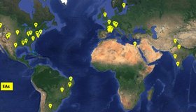
Summary of the 10th SWOT Applications Workshop
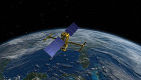
The tenth Surface Water Ocean Topography (SWOT) Applications Workshop brought together the community to hear about the mission status and to explore the many facets of operational and applied uses of SWOT data.
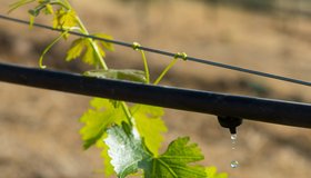
Scaling Up Climate Smart Irrigation Projects in Oregon
The Freshwater Trust has expanded its innovative agreement with the Oregon Natural Resources Conservation Service, a division of the USDA, to recruit, design, and develop a large queue of priority projects.

How Cities Run Dry
Rivers, lakes, and reservoirs long strained by overuse now face climate change. Some cities are turning to water restrictions to get back on track.

Navigating the Rapid Rivers of Policy
Scientific data and shared commitments help define new approaches to water management and science communication.
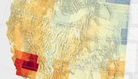
Groundwater Declines in U.S. Southwest
Record snowfall has not been enough to offset groundwater losses amid long-term drying and a heightened demand for the resource.

Connecting Water Managers to NASA Earth Data
WWAO looks ahead to new Earth data and new relationships with decision makers.
Improving Seasonal Water Predictions Using a Machine-Learning River Forecast System
A WWAO collaboration has published a new paper on how to use next-generation satellite snow data to improve seasonal water supply forecasts using machine learning.
Webinar: Accessing Data for World's Water with NASA's SWOT Mission
Learn how to discover, access, and use Surface Water and Ocean Topography (SWOT) mission data and how these data could lead to new, innovative science and applications in the world of water.

California Water Department Completes First Phase of Innovative Groundwater Mapping Program
State-of-the-art helicopter-based technology and local coordination improve management of our underground water supply.

SWOT Observes Coastal Flooding
The Surface Water and Ocean Topography satellite provides a new view of water on land, at the coast, and in the ocean.