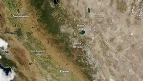
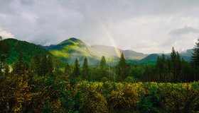
Sierra Snowbank Short on Funds
Mountain snow – a bank account for water across the western U.S. – has turned up insufficient funds this year. The Sierra Nevada snowpack melted nearly a month earlier than usual, leaving reservoirs without their usual inflow of freshwater.
NASA Strengthens Our Resilience to Drought
In the face of severe west-U.S. drought, NASA has launched a new page highlighting its eyes on the drought, which are helping track and monitor the ongoing drought, predict how much water will be available, and improve how we use the water we have.

Water-Tracking Satellite Moves Closer to Blastoff
Set for launch next year, the Surface Water and Ocean Topography mission will help scientists monitor Earth’s oceans, as well as the amount of freshwater in its lakes and rivers.
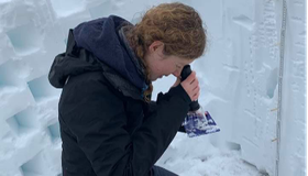
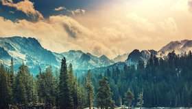
NASA Snow Campaign Wraps For 2021
The 2021 SnowEx field campaign, which is helping determine how much water winter snowpack holds, has come to a close. Teams took snow measurements at six sites across the western U.S., on the ground and with drones and airplanes flying overhead.
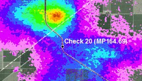
The Central California Town That Keeps Sinking
The very ground upon which Corcoran lies has dipped nearly 12 feet in 14 years as a result of pumping of underground water for irrigation. Scientists can track the subsidence in the region using radar and satellite technology.
Satellites Show Water Cycle Ramping up as Climate Warms
For years, scientists looked for ways to measure large-scale changes in Earth’s water cycle. Satellites measuring the gravity of water delivered. From 2003 to 2019, land evapotranspiration increased by 10%, one sign that our water cycle is ramping up.
Reclamation Provides $2.5M For Snow Water-Supply Forecasting
The U.S. Bureau of Reclamation has announced $2.5 million of funding for 12 projects to advance snow measurement technology with the goal of improving water-supply forecasts.
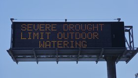
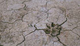
California Expands Drought Emergency to Large Swath of State
After one of the warmest, driest springs on record, most of the American west is in extensive drought. Amid acute water shortages in northern and central California, a drought emergency has been expanded to a large swath of the state.
Covering Canals With Solar Panels Could Reduce Emissions, Save Water
A new study finds that covering thousands of miles of California’s canals with solar panels could help the state meet its ambitious goals to reduce greenhouse emissions as well as improve irrigation management.
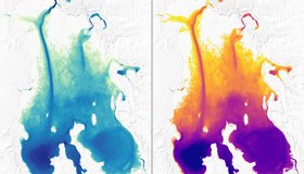
Sizing up Remote Lakes From Space
Researchers have found a new way to measure the depth of some of the most isolated, shallow lakes, using NASA's ICESat-2 satellite. Knowing the shapes of lake beds in dry regions enables us to better estimate the amount of water stored in these basins.