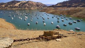
California’s Largest Reservoirs Are Critically Low
Images from Lake Oroville and Lake Shasta compiled by the state show ‘a shocking drop in water levels’ compared to years past. California, like much of the U.S. West can expect a searing, dry summer ahead.
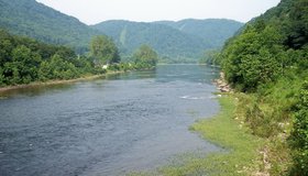
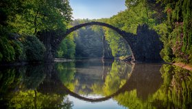
Flood Vulnerability in The Cheat River Watershed
Communities in the Cheat River watershed in West Virginia face frequent flooding, which threatens to reverse years of restoration work aimed at cleaning up pollution from mining. NASA has partnered with a local non-profit to help build resilience to future floods.
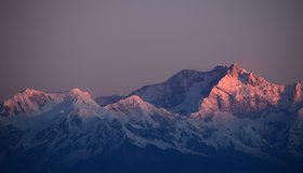
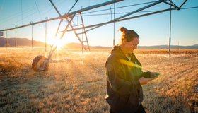
Getting Water Out of Snow With NASA Technology
How much water is in mountain snowpack? That’s a question science has been attempting to solve for decades. Finally, NASA-developed technology provides an accurate answer, using a cutting-edge airborne sensor system and sophisticated software that also predicts when snow will melt.
NASA's New Water Use And Crop Yield Simulator
NASA has co-launched a new modeling framework for assessing water use and estimating crop yields at regional levels. GEO-CropSim integrates Earth observations into crop models to help decision makers manage crop production while analyzing water use.
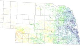
OpenET: Transforming How we Track Water
OpenET is a satellite-based tool that supplies critical information on water use in 17 western U.S. states. It will help farmers and water managers better understand water use and water lost through evapotranspiration.
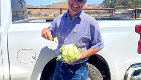
Keeping America's Salad Bowl Full
In seasons when water is scarce, tools powered by NASA data can help farmers decide where to allocate water and nutrients for irrigation and fertilizer.
Call For Abstracts: A Valley of Opportunity
WWAO is hosting a session at the American Meteorological Society's 102nd Annual Meeting in January 2022. We invite you to join our discussion on building water solutions that harness satellite data to address decision-maker needs.
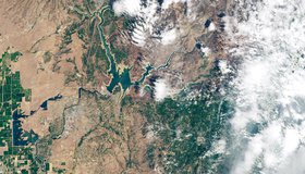
NASA Images Hone in on California’s Severe Drought
California’s reservoirs are rapidly drying up and the water level in Shasta Lake — the largest reservoir in the state — has dipped to about 35% of its capacity. The L.A. Times spoke to WWAO about how the drought looks from space.
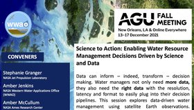
Call For Abstracts: Data-Driven Water Management
WWAO is hosting a session at the 2021 American Geophysical Union Fall Meeting this December. Part of the conference’s Science to Action track, our session looks at how to improve water management using satellite Earth observations. We invite you to join us.
NASA Training on Coastal/Estuarine Water Quality
NASA’s Applied Remote Sensing Training Program (ARSET) is offering a Monitoring Coastal and Estuarine Water Quality webinar as part of its effort to train, empower and advance.