
NASA Sees Spike in 2023 Sea Levels Due to El Niño
A long-term sea level dataset shows ocean surface heights continuing to rise at faster and faster rates over decades of observations.
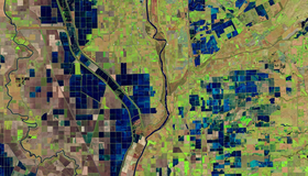
OpenET Study Helps Water Managers and Farmers Put NASA Data to Work
As the world looks for sustainable solutions, a system tapping into NASA satellite data for water management has passed a critical test.
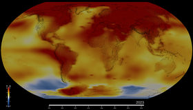
NASA Confirms 2023 as Warmest Year on Record
Global temperatures last year were around 2.1 degrees Fahrenheit (1.2 degrees Celsius) above the average for NASA’s baseline period (1951-1980).
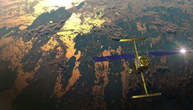
US-Indian Satellite Will Monitor Earth’s Changing Frozen Regions
NISAR, the soon-to-launch radar satellite from NASA and the Indian Space Research Organisation, will track changes in wetlands as well as other Earth vital signs.
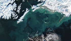
Colorful Swirls in the Gulf of Alaska
The burst of turquoise and tan hues in Alaskan waters is in stark contrast to the snowy shoreline.
Bringing NASA's Water Data to Life
Google's immersive experience, "A Passage of Water", uses satellite data to illustrate how climate change is affecting Earth’s water cycle.

NASA to Showcase Earth Science Data at COP28
NASA will share its Earth science data and knowhow at the 28th U.N. Climate Change Conference of the Parties (COP28).
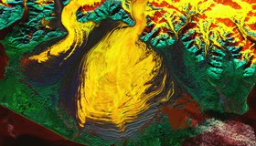
Malaspina Glacier in a Riot of Color
Beautiful color palette reveals the features of an iconic glacial landscape in southeastern Alaska.

NASA/Esri Agreement Boosts Use of NASA Geospatial Data
A new Space Act Agreement between NASA and Esri expands worldwide access to NASA's geospatial content for research and exploration — including new datasets from nearly 100 spaceborne sensors.
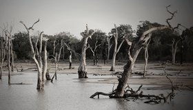
NASA Earthdata Floods Toolkit
About 40% of the world's population live within 100 km of the coast, and floods affect more people than any other type of natural disaster. NASA's floods toolkit offers easy access to NASA Earth data that can help scientists and decision makers understand floods, respond to them, and map their impact.