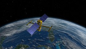
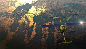
Watch the Latest Water Satellite Unfold in Space
Cameras on the Surface Water and Ocean Topography spacecraft captured the antennas for its main science instrument unfurling in orbit.
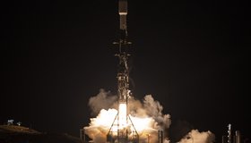
NASA Launches International Mission to Survey Earth's Water
Led by NASA and the French space agency CNES, the Surface Water and Ocean Topography mission will provide high-definition data on nearly all the water on our planet’s surface.
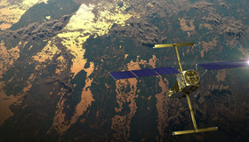
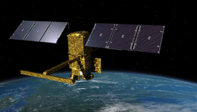
Latest Water Satellite Packs Engineering Punch
Meet the scientific heart of the Surface Water and Ocean Topography mission, which will see Earth’s water in higher definition than ever before.
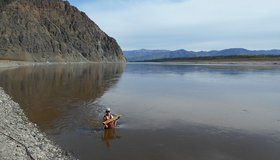
Water Mission to Gauge Alaskan Rivers on Front Lines of Climate Change
The upcoming Surface Water and Ocean Topography mission will provide a trove of data on Earth’s water resources, even in remote locations. Alaska serves as a case study.

Event: NASA Earth Science Applications Week
Join us for NASA’s Earth Science Applications Week 2022! A three-day virtual celebration of the many ways NASA Earth science is being used to make our world a better place.

NASA 2021 Water Resources Solicitation
NASA has released a 2021 solicitation for water-resource proposals through NASA's Research Opportunities in Space and Earth Sciences (ROSES). The first-round deadline is May 21, 2021.

We're All Connected
From big to small...we’re all connected. In honor of Earth Day this week, NASA is hosting an Earth Day Virtual Event and releasing a range of activities, live talks, games, videos and great downloadable posters and books.
US-French Satellite Takes Stock of World’s River Water
In a first, a space mission led by NASA and France has tracked Earth’s rivers swelling and shrinking from month to month over the course of a year and found significantly less of a swing than previous model-based estimates.
NASA’s Western Water Action Office (WWAO) Partners with Hazen and Sawyer to Improve Western Water Decision-Making Using NASA Earth Data
An exciting collaboration harnessing 65 years of NASA Earth monitoring and state-of-the-art data to support smarter water management across the Western U.S.

Informing Food Security and Health Applications in the Chesapeake Watershed with Remote Sensing
The Chesapeake Bay Working Group at Goddard includes several stakeholders who collectively review how NASA satellite data can help support a variety of needs in the largest North American estuary.