
Bringing NASA's Water Data to Life
Google's immersive experience, "A Passage of Water", uses satellite data to illustrate how climate change is affecting Earth’s water cycle.

NASA to Showcase Earth Science Data at COP28
NASA will share its Earth science data and knowhow at the 28th U.N. Climate Change Conference of the Parties (COP28).

NASA/Esri Agreement Boosts Use of NASA Geospatial Data
A new Space Act Agreement between NASA and Esri expands worldwide access to NASA's geospatial content for research and exploration — including new datasets from nearly 100 spaceborne sensors.
NASA's Water Portal Launched
Our new NASA Water Portal is now live. The portal serves as a hub for building connections between our catalogs of Water Data Needs and Water Capabilities and our partners, including water managers, decision makers, and scientists.
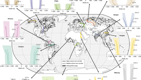
Wide-swath altimetry maps bank shapes and storage changes in global rivers
Here we present near-global-scale observations of active river channel geometry and associated monthly changes in water storage at the reach scale derived from the first water year (October 2023 to September 2024) of the Surface Water and Ocean Topography (SWOT) mission at 126,674 reaches worldwide.

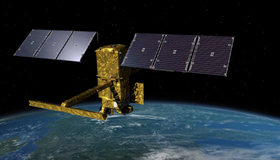
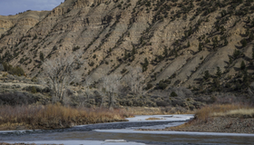
US-French Satellite Takes Stock of World’s River Water
In a first, a space mission led by NASA and France has tracked Earth’s rivers swelling and shrinking from month to month over the course of a year and found significantly less of a swing than previous model-based estimates.
NASA’s Western Water Action Office (WWAO) Partners with Hazen and Sawyer to Improve Western Water Decision-Making Using NASA Earth Data
An exciting collaboration harnessing 65 years of NASA Earth monitoring and state-of-the-art data to support smarter water management across the Western U.S.
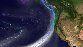
Wet Soils Increase Flooding During Atmospheric River Storms
A new study published in the Journal of Hydrometeorology this month demonstrates that the amount of water in soil, in addition the strength of a storm, can determine the risk of flooding.
Low snowpack stirs 2018 fire seaon flashbacks, but wet monsoon season may offer hope
While the short-term expectation is a less active and shortened recreation season, there may be a better chance of precipitation in late summer.
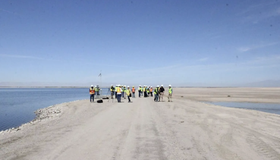
Officials Celebrate Flooding of Expanded Habitat at the Salton Sea
The flooding of a 750-acre addition next to the Salton Sea is part of a larger habitat restoration plan of more than 9,000 acres.