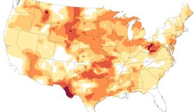
Drought Expands Across the U.S.
Dry conditions parched all but two states in October 2024 and worsened as the month progressed.
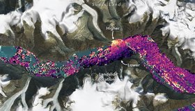
International SWOT Satellite Spots Planet-Rumbling Greenland Tsunami
Data from space shows water tilting up toward the north side of the Dickson Fjord as it sloshed from south to north and back every 90 seconds for nine days after a 2023 rockslide.
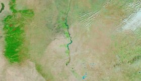
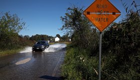
A Deluge for Roswell
The city in southeastern New Mexico received four times more rainfall in a day than it usually receives in a month.
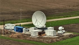
GPM Mission Celebrates Ten Years of Observing Precipitation
On February 27, 2014, the four-ton Global Precipitation Measurement (GPM) Core Observatory spacecraft launched aboard a Japanese H-IIA rocket from Tanegashima Space Center in southern Japan.
Summary of the 10th SWOT Applications Workshop
The tenth Surface Water Ocean Topography (SWOT) Applications Workshop brought together the community to hear about the mission status and to explore the many facets of operational and applied uses of SWOT data.
NASA Helps Build New Federal Sea Level Rise Website
Designed to be user-friendly, the new website contains the latest sea level data, explainers, and other information from several U.S. agencies.
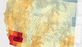
Groundwater Declines in U.S. Southwest
Record snowfall has not been enough to offset groundwater losses amid long-term drying and a heightened demand for the resource.

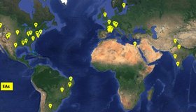
Connecting Water Managers to NASA Earth Data
WWAO looks ahead to new Earth data and new relationships with decision makers.

Improving Seasonal Water Predictions Using a Machine-Learning River Forecast System
A WWAO collaboration has published a new paper on how to use next-generation satellite snow data to improve seasonal water supply forecasts using machine learning.
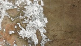
Snowstorm Coats the Rockies
A potent storm pushed snowpack levels above normal across Colorado.