Climate Change Made Hurricane Harvey's Flooding Worse
New research shows that if it were not for climate change, up to 50 percent of residences in Houston's Harris County would not have been flooded by Hurricane Harvey five years ago.

Cities Grapple Future Risk After Recent Flash Floods
Dallas is only the latest flood disaster. The many effects associated with flooding show why a holistic approach to planning for climate change is needed, and what communities can learn from one another in the face of a warming planet.
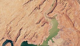
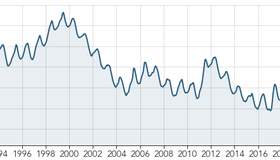
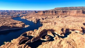
Lake Powell Still Shrinking
The second largest reservoir in the United States now stands at its lowest level since it was filled in the mid-1960s.
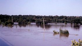
Rio Grande Runs Dry, Then Wet
Residents of Albuquerque saw a dry riverbed for the first time since 1983.
More Evidence of California's Extreme Weather Trend
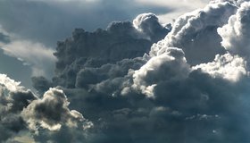
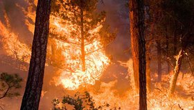
New research shows the risk of hazardous weather is increasing in the Southwest U.S. More hot, dry winds, less rainfall and greater numbers of winter wildfires are the result.
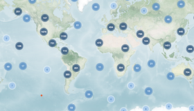
One Look is Worth a Thousand Words
For 20 years NASA's Earth Observatory has told stories of our planet. Its Earth Explorer atlas features 12,000 images showing what's happening locally or on the other side of the world.
The Great Shrinking Lake
In summer 2022, water levels in the Great Salt Lake dropped to new record lows. Increased water diversions and climate change are responsible.
Flash Floods in Death Valley
In one of the driest places on Earth, a thousand-year rain event delivered 75 percent of the yearly average precipitation in just three hours.
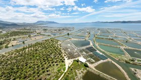
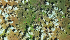
Shrimp Farm Shape Affects Groundwater Pollution
Coastal aquaculture has grown rapidly in recent decades. New findings may help decision makers optimize shrimp-farm layouts, which could help improve coastal water quality.
Building Resilience as The Colorado River Dwindles
Policymakers, industry and conservation players, and tribal members explore paths to a sustainable future for the millions who rely on the “lifeblood of the American West.”