Global Wetlands Losses High But Overestimated
Although wetlands remain threatened in many parts of the world — including the U.S., which accounts for more losses than any other country — worldwide wetland losses have likely been overestimated, according to a new study in Nature.
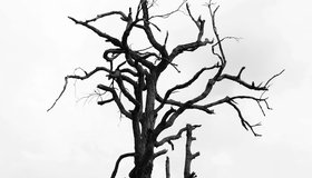
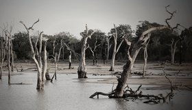
Drought Mainly to Blame For Uptick in California Tree Deaths
About 36 million dead trees were recorded in California last year, a dramatic increase from previous years. A report by the U.S. Forest Service explains the die-offs are the result of drought, insects and disease.
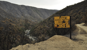
A Double Whammy: Wildfire Debris Pollutes Drinking Water
As our climate changes, extreme wildfires are becoming the norm. They cover the ground with debris that can contaminate watersheds and drinking water supplies after a heavy rain.

NASA/Esri Agreement Boosts Use of NASA Geospatial Data
A new Space Act Agreement between NASA and Esri expands worldwide access to NASA's geospatial content for research and exploration — including new datasets from nearly 100 spaceborne sensors.
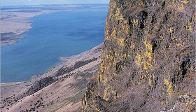
Shrinking Lake Abert
Image of the day: As the lake in southern Oregon dries up, the remaining water is becoming too salty to support key food sources for birds.
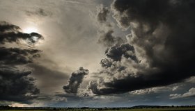
Whiplash weather: Learning From California’s Deadly Storms
How can communities better prepare for the dramatic swings between flood and drought that the western U.S. is experiencing?
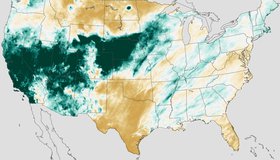
Atmospheric Rivers Take Chunk Out of Drought
Nine atmospheric rivers dropped feet of rain and snow across California and the West Coast from late December to mid-January. The deluge caused deaths, landslides and flooding, but improved the drought situation across a large chunk of the western United States.
NASA Earthdata Floods Toolkit
About 40% of the world's population live within 100 km of the coast, and floods affect more people than any other type of natural disaster. NASA's floods toolkit offers easy access to NASA Earth data that can help scientists and decision makers understand floods, respond to them, and map their impact.
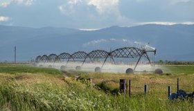
NASA Measures Underground Water Flowing From Sierra to California's Central Valley
This source accounts for about 10% of all the water that enters this highly productive farmland, including rivers and rain.
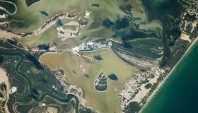
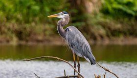
Rio Grande, Meet the Gulf of Mexico
Colorful waterways and wetlands are visible along the river that defines a portion of the U.S.-Mexico border.