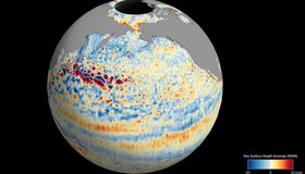
SWOT's Unprecedented View of Global Sea Levels
Sea surface height data from the international Surface Water and Ocean Topography mission yields a mesmerizing view of the planet’s ocean.
NASA Earthdata Floods Toolkit
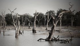
About 40% of the world's population live within 100 km of the coast, and floods affect more people than any other type of natural disaster. NASA's floods toolkit offers easy access to NASA Earth data that can help scientists and decision makers understand floods, respond to them, and map their impact.

NASA Makes Sense of Earth’s Subtle Motions
What can hidden motions underground tell us about groundwater, climate change, earthquakes and eruptions? NASA scientists are using data gathered 400 miles above Earth to find out.
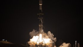
NASA Launches International Mission to Survey Earth's Water
Led by NASA and the French space agency CNES, the Surface Water and Ocean Topography mission will provide high-definition data on nearly all the water on our planet’s surface.
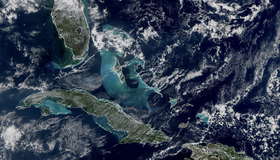
First Images Released From NOAA-21 VIIRS Instrument
Bright blue water in the Caribbean Sea and smog in Northern India appear in the first worldwide image produced with data from NOAA-21’s VIIRS instrument, which began collecting Earth data in December. VIIRS offers global insight into our atmosphere, land, and oceans.
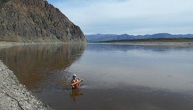
Water Mission to Gauge Alaskan Rivers on Front Lines of Climate Change
The upcoming Surface Water and Ocean Topography mission will provide a trove of data on Earth’s water resources, even in remote locations. Alaska serves as a case study.

Event: 2022 National Water Use Data Workshop
The 2022 National Water Use Data Workshop will focus on improving water-data management and sharing. The event is led by WWAO collaborators including the Western States Water Council Water Information Management Systems Group, U.S. Geological Survey, Interstate Council on Water Policy, and Internet of Water.
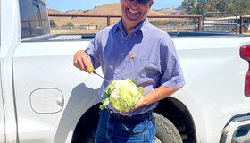
Keeping America's Salad Bowl Full
In seasons when water is scarce, tools powered by NASA data can help farmers decide where to allocate water and nutrients for irrigation and fertilizer.

Call For Abstracts: A Valley of Opportunity
WWAO is hosting a session at the American Meteorological Society's 102nd Annual Meeting in January 2022. We invite you to join our discussion on building water solutions that harness satellite data to address decision-maker needs.
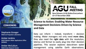
Call For Abstracts: Data-Driven Water Management
WWAO is hosting a session at the 2021 American Geophysical Union Fall Meeting this December. Part of the conference’s Science to Action track, our session looks at how to improve water management using satellite Earth observations. We invite you to join us.